uncover
The Space In Between
Where land and water come together
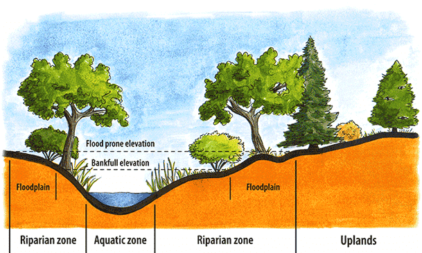
What do we call the places where land and water meet? Are they fully terrestrial or fully aquatic? What if they spend half the year covered in water or even half the day - like in a tidal zone? What if they are places that are mostly dry, but several times a year they get flooded? Within these narrow ranges where aquatic and terrestrial systems meet, some special things happen. These areas are considered riparian zones or wetlands, depending on the soils and plants you find there.
Riparian Systems
from OSU Extension Service
Riparian areas tend to occur as vegetated strips of land that form a boundary along rivers, streams, lakes, reservoirs, ponds, springs, etc. They have attributes of both upland (terrestrial) and aquatic systems and are wetter than average, but are not always underwater.
From an ecological point of view, healthy riparian areas are diverse and productive. In the U.S., they provide habitat for about one third of all plants and more than half of all vertebrates (animals with backbones). Riparian soils are rich in nutrients from organic matter. They are flooded regularly which positively affects the biodiversity of both plants and animals. An estimated 70% of threatened and endangered species in the U.S. depend on riparian systems to survive.
Healthy riparian areas can maintain or improve water quality. As flooding or runoff occurs, plants in a riparian zone slow down the water. The plants then capture sediment, nutrients, and pollutants like pesticides and heavy metals. Riparian zones reduce the pollutants that reach the water, helping keep water clean and healthy.
Riparian areas also benefit humans, offering recreational and economic benefits. The land around riparian zones can be used for recreational activities like hiking, camping, hunting, fishing, and even agriculture. These activities can bring economic support to surrounding communities.
Stable, healthy, and resilient riparian systems protect and improve water bodies and surrounding areas. However there is a limit to how much runoff a riparian system can manage before it becomes overloaded. We can keep riparian systems healthy with good land-use practices further upland.
Wetlands
from EPA page on wetlands
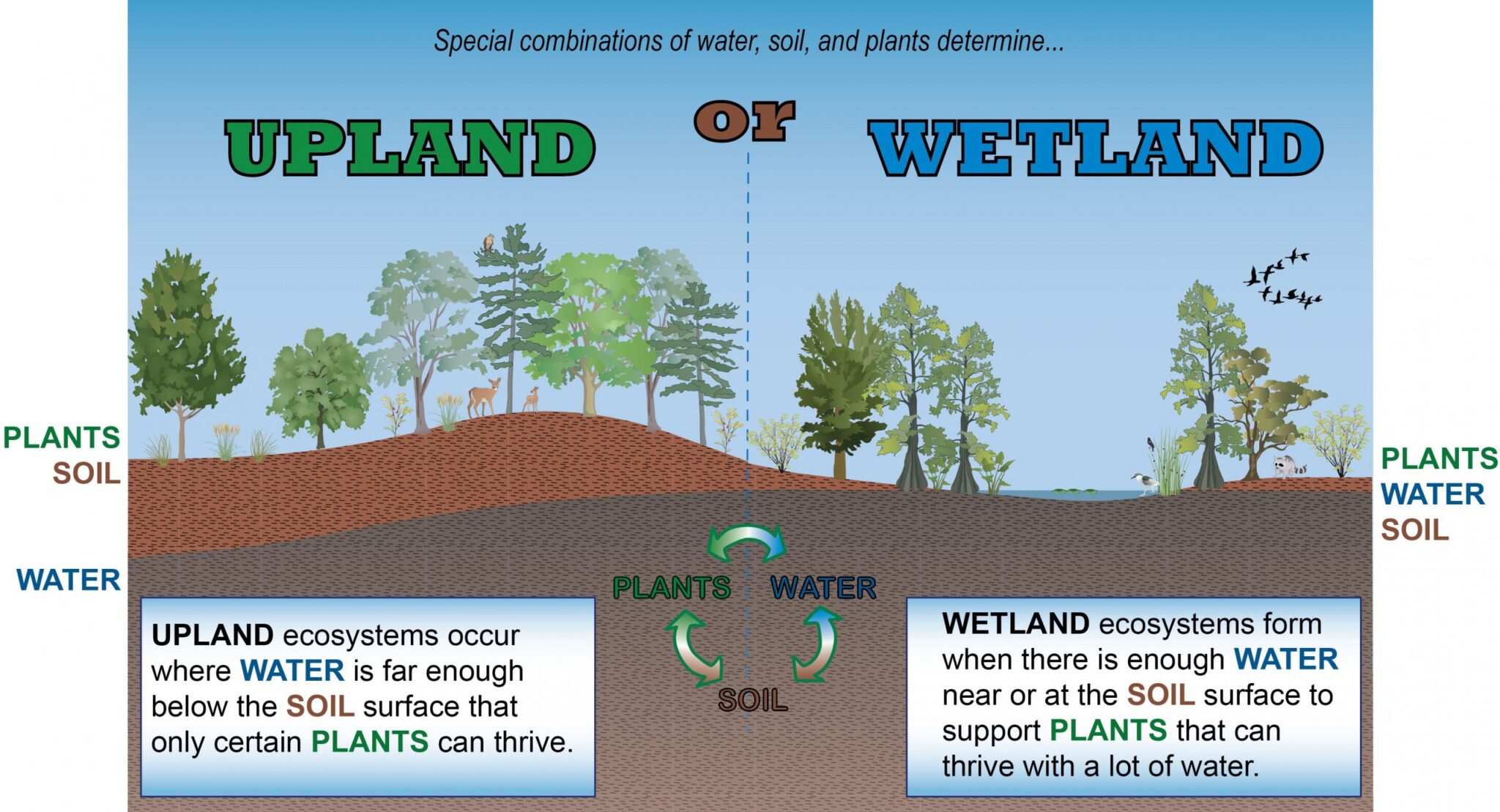
Wetlands are areas where water covers the soil or is near the surface of the soil for all or most of the year, including during the growing season. Wetlands include swamps, marshes, bogs, and fens. When soil is saturated, filled with water, it affects how the soil develops and the types of plant and animals living in and on the soil. Soil that is filled with water is called hydric soil. Specially adapted plants called hydrophytes grow in hydric soils. Wetlands may support both aquatic (water) and terrestrial (land) species of animals.
Wetlands vary widely because of regional and local differences in many factors including climate, land forms, types of plants, and quality of the water. Human disturbance like roads and buildings can also affect the types of wetlands in an area. Wetlands are found from the tundra to the tropics and on every continent except Antarctica. There are two general types of wetlands: coastal or tidal wetlands and inland or non-tidal wetlands.
To learn more: National Geographic Resource Library - Wetland
Coastal/ Tidal Wetlands
Coastal wetlands are also called tidal wetlands because they are affected by the tides. In the U.S., they are found along the Atlantic, Pacific, Alaskan, and Gulf coasts. They are closely linked to our nation's estuaries where sea water mixes with fresh water to form an environment of brackish water. The salt and changing water levels (due to tides) combine to form mud flats or sand flats, difficult environments for most plant species to survive. However, certain grasses and grasslike plant species have adapted to handle these salty conditions. These salt-tolerant grasses form tidal salt marshes that are found along the Atlantic, Gulf, and Pacific coasts.
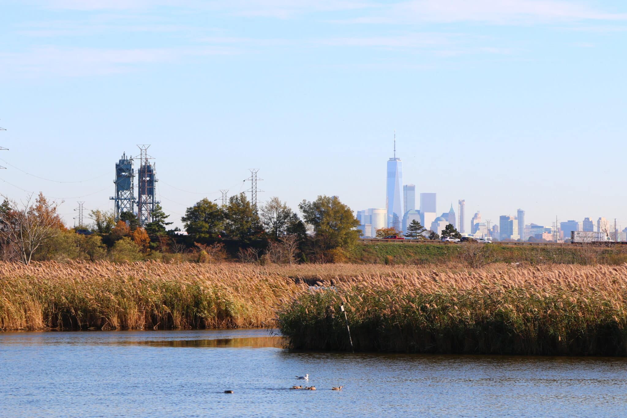
Mangrove swamps, with salt-loving shrubs or trees, are common in tropical climates, such as in southern Florida and Puerto Rico. Parts of the Hackensack Meadowlands are salt marshes that contain a salt tolerant marsh grass called smooth cordgrass (Spartina alterniflora). Before this area was urbanized, it was mostly covered with swamps, bogs, marshes, and salt marshes.


Inland/ Non-tidal Wetlands
Inland wetlands are also called non-tidal wetlands. They are most common on floodplains along rivers and streams - riparian wetlands, along the edges of lakes and ponds, and in other low-lying areas. Anywhere where the groundwater rises to the soil surface or where precipitation falls enough to saturate the soil is a wetland. There are different types of inland wetlands. Marshes and wet meadows support mostly plants with soft, not-woody stems. Swamps contain mostly shrubs, and wooded swamps have many trees growing. Certain types of inland wetlands are common to particular regions of the country. For more information, see Wetland Classifications and Types from the EPA for a full list.
Many of these non-tidal wetlands are seasonal, or ephemeral, which means they are dry for portions of the year. In very dry areas, inland wetlands may only be wet occasionally. The amount of water and the timing of its presence help determine the functions of a wetland and its role in the environment. Even wetlands that are dry for long parts of the year often provide critical habitat for wildlife during certain parts of their life cycle. This wildlife is adapted to breed when these wetlands have water.
Click on this link to find the New Jersey Flood Mapper. This map shows you the riparian zones - land areas that can flood because they are next to bodies of water like lakes and rivers. These areas flood naturally. The Flood Mapper tool shows you these areas at different water levels. Use the “Tour” button in the upper right corner to learn a little about the map.

